The last town on Route 66 to be bypassed by Interstate 40, and the southern end of the railway to the Grand Canyon.
1,760 mi from Chicago
3 stories to hear
Free in the app through 2027
Allow one cookie to recognise return visits? No cross-site tracking. Privacy
About Williams
Williams was founded in 1881 and named for William Sherley “Old Bill” Williams, a trapper, trader, scout and mountain man who often trapped in the area; the mountain south of town carries his name too. The town is the southern terminus of the Grand Canyon Railway, which takes visitors to Grand Canyon Village.
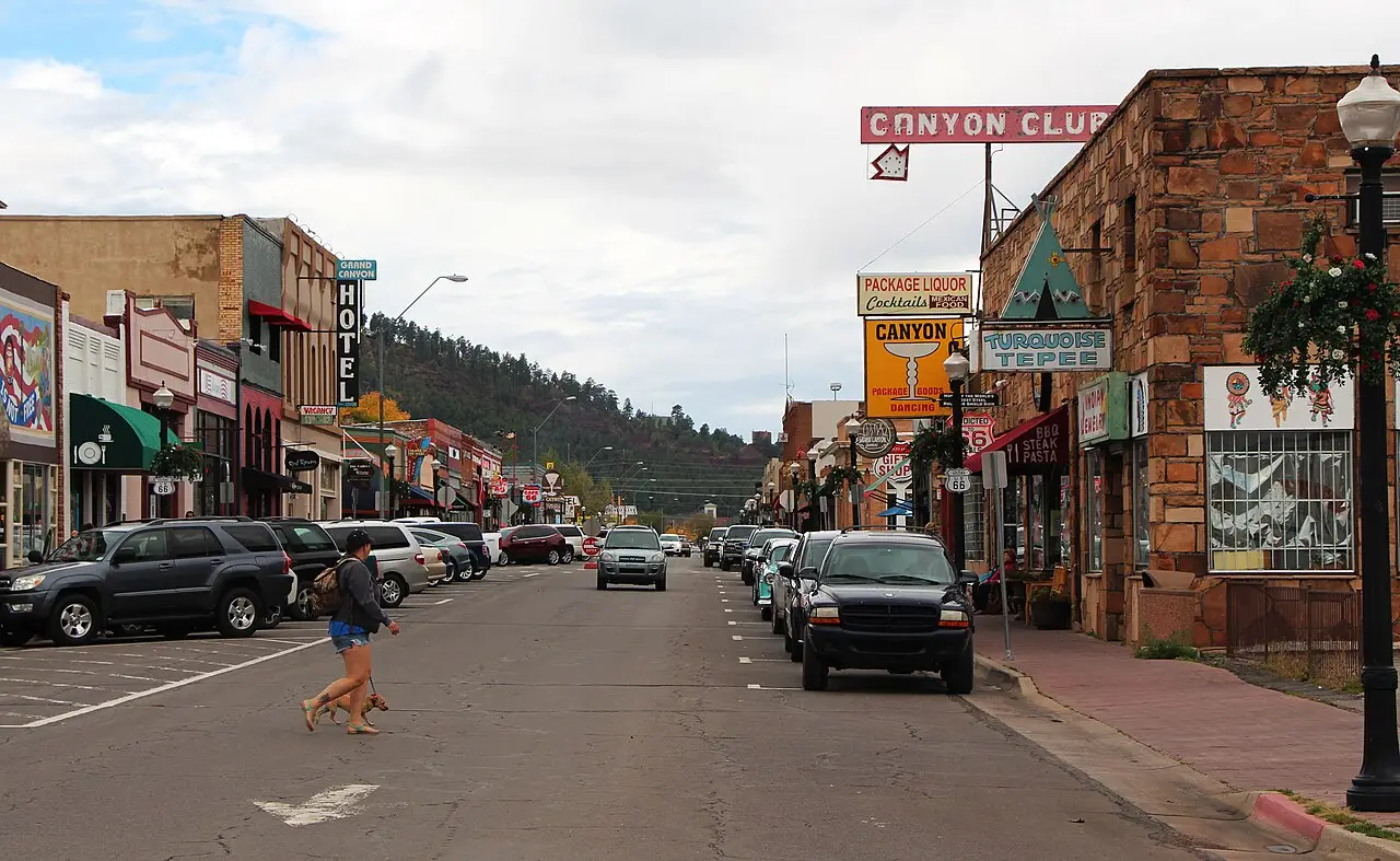
Route 66 runs down the middle of the historic business district as Bill Williams Avenue. Williams was the last town on the highway to be bypassed: lawsuits held up the final section of Interstate 40 in Arizona until a settlement promised three Williams exits. The interstate opened around town on October 13, 1984, and Route 66 was decommissioned the following year.
On the road, Lorecast plays these on its own as you drive past each place. Here you can listen first. Each story lists its sources.
HISTORY · TOLD BY MILES · 69 SEC
Named for a man who never saw it
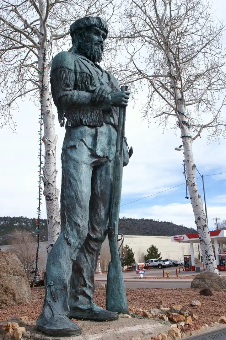
Williams, Arizona — founded in 1881, named for a man who died 32 years earlier. William Sherley "Old Bill" Williams was a trapper, trader, scout, and mountain man who often trapped in this area. He never saw the town that would bear his name. But his statue stands in Monument Park today, and the mountain south of town is named for him. Williams became the "Gateway to the Grand Canyon" — the southern terminus of the Grand Canyon Railway, which still takes visitors north. But here's the story that made Williams famous: it was the last town on Historic Route 66 to be bypassed by Interstate 40. Lawsuits kept the final section of I-40 from being built around the city. After settlements called for three Williams exits, the suits were dropped. On October 13, 1984, I-40 opened around the town. Newspapers the next day reported the essential end of US 66. The following year, Route 66 was decommissioned. Williams held on the longest.
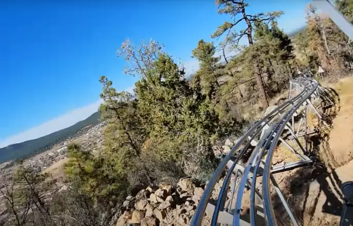
A mountain coaster in Arizona — the first one, actually. But here's the twist: the people who built it had already built another coaster in California, the Mineshaft Coaster at Big Bear Lake. Bruce and Kim Voigt, along with Scott and Louis Towsley, brought that experience to Williams. The park opened in 2022, but not without friction. Local citizens opposed the rezoning — worried about noise and traffic near a residential area. Then supply chain issues delayed the opening. When it finally soft-opened on April 8, 2022, it was only for residents of Williams and nearby cities. The coaster itself is 35 feet tall, a mile long, built into the mountain so the curves follow the natural landscape. Riders control their own speed and braking.
What's a ranger station doing with a corral? That's the first odd thing about Camp Clover. Built in 1934, it's a cluster of five buildings and one structure — that corral — sitting on three acres west of Williams. The buildings are Bungalow/Craftsman style, designed by the USDA Forest Service. It served as housing and government offices. But here's the twist: the corral is listed as a 'contributing structure' to its historic status. A corral. On a ranger station. That means the National Register considers that corral part of the architectural story — right alongside the office and the residence. So next time you see a corral, maybe look twice.
Route 66 runs down the middle of the historic business district as Bill Williams Avenue. Look for the Cabinet Saloon and the Pollock Building, built of native dacite, and the yellow-brick Tetzlaff Building.
The Santa Fe built this depot in 1908 with the Fray Marcos, one of the first Harvey House hotels, inside. The hotel closed in 1954; the building is Arizona’s oldest poured-concrete structure and the Grand Canyon Railway’s southern terminus.
A museum of coprolites — fossilized feces — that opened on Route 66 in 2024. It holds 8,000 of them, including Barnum, a 20.5-pound specimen believed to be from a Tyrannosaurus rex.
A drive-through wildlife park on Historic Route 66 east of town, opened in 2010 by Sean and Dennis Casey, whose parents founded Bear Country USA in South Dakota. It is known for its black bear cubs.
Home of Arizona’s first mountain coaster, opened in 2022: a mile of track built into the hillside, with riders controlling their own speed. The park also offers tubing in summer and winter.
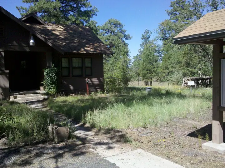
Built in 1934 by the Civilian Conservation Corps about two miles west of town: five Craftsman-style buildings and a corral, listed on the National Register in 1993 for their architecture.
Founded as a railroad siding in October 1882, Ash Fork calls itself “The Flagstone Capital of the World” for its many stone quarries, a title the Arizona House of Representatives made official in 2014. Route 66 still runs through town as Park and Lewis Avenues.
Let Williams tell its own stories as you drive in.
Lorecast plays short stories about the places around you, hands-free. Download Route 66 before you leave and it works offline. Route 66 is free through December 31, 2027.
How these stories are made
Lorecast stories are written with AI using only the sources listed under each story, and they are narrated with synthetic voices. An automatic check traces every name and date back to those sources, and legends are told as legends. Every story on this page was also checked against its sources before we published it here. If you spot a mistake, write to hello@lorecast.net.