California holds Route 66’s last 316 miles: Mojave Desert from Needles, the climb to Cajon Pass, then city streets to the Pacific at Santa Monica.
360 mi along our route
3 towns in this guide
16 stories to hear
Allow one cookie to recognise return visits? No cross-site tracking. Privacy
Route 66 in California
Route 66 ran about 316 miles across California, from Needles at the Arizona line through San Bernardino and Los Angeles to Santa Monica on the Pacific. It was truncated in the 1964 renumbering, and its signs came down in 1974.
East of San Bernardino the road followed the National Old Trails Road over Cajon Pass and across the desert. It is Main Street through Barstow; past Barstow a Marine Corps base forces traffic onto I-40, and from Daggett the old road winds away through Bagdad, Amboy and Essex. One portion in San Bernardino County is closed for bridge repairs.
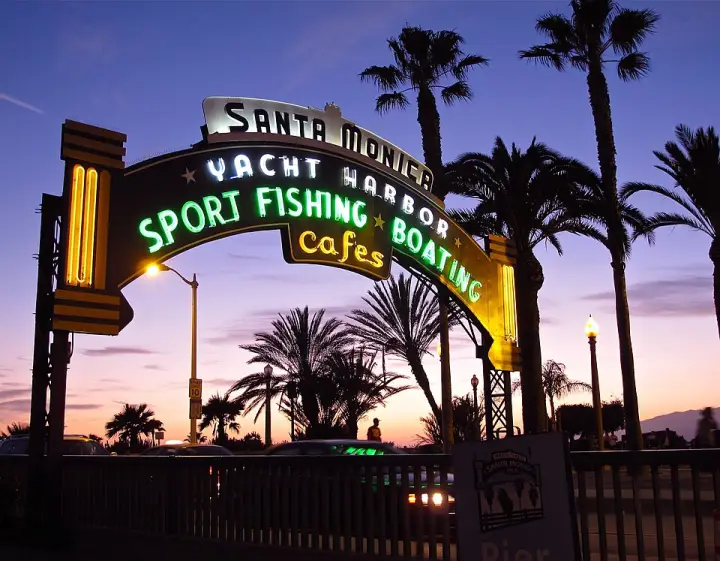
West of San Bernardino it is city streets: Foothill Boulevard, Huntington Drive, Colorado Boulevard through Pasadena, the Arroyo Seco Parkway, then Sunset and Santa Monica boulevards. These are the busiest Route 66 segments but the least traveled by enthusiasts, and guidebooks often suggest I-10 from San Bernardino to Santa Monica instead.
Stories Lorecast plays on the open road in California, in the order you reach them driving west.
HISTORY · TOLD BY MILES · 51 SEC
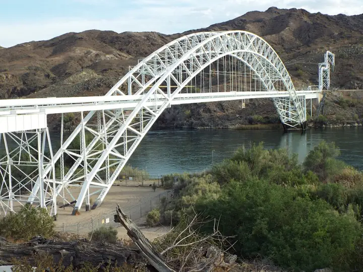
The Old Trails Bridge into California
Old Trails Bridge was once a vital link for travelers crossing the Colorado River between San Bernardino County and Mohave County. Built between 1915 and 1916, this brace-ribbed through arch bridge carried a section of the former U.S. Route 66, connecting southeast of Needles, California, to south of Topock, Arizona. For decades, it served as a highway bridge, but its role changed in 1947 when the Red Rock Bridge was modified for highway use. After that, the structure was eventually converted into a pipeline bridge. It’s a piece of history that has even appeared in blockbuster films like The Grapes of Wrath and Easy Rider. It was officially listed on the National Register of Historic Places on September 30, 1988.
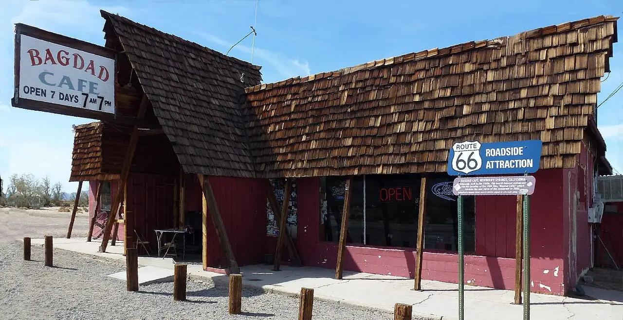
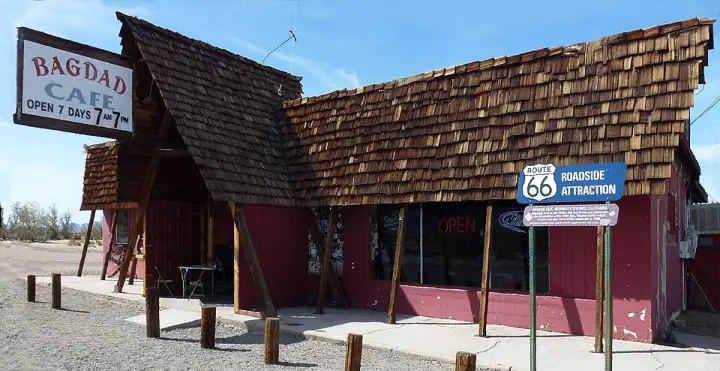
In 1984, director Percy Adlon and his wife took a road trip across Route 66. They stopped in Barstow, California, which reminded them of 'purgatory.' That trip inspired a film—Bagdad Cafe—released in 1987. The story: a German tourist named Jasmin storms out of her husband's car in the Mojave Desert, walks to an isolated truck stop, and slowly transforms the place and its people. The film was shot not at the real Bagdad Cafe (the town of Bagdad had been abandoned after Interstate 40 bypassed it in 1973), but at the Sidewinder Cafe in Newberry Springs, 50 miles west. After the film became a hit—especially in Europe—the cafe's new owners in 1995 changed its name to Bagdad Cafe. It's still there, a small noticeboard on the wall holding snapshots of the cast and crew.
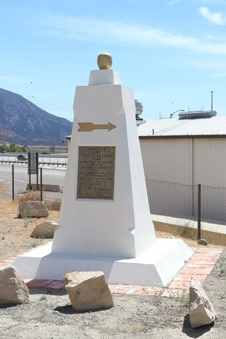
You know that moment when you're driving through a canyon and you realize the road you're on is just the latest version of a trail that's been walked for centuries? That's the story of Cajon Pass. In 1917, the Pioneer Society of San Bernardino built a 12-foot-tall white monument here to mark where the Old Spanish Trail and Mormon Road once passed through. They built it because the canyon road had been moved away from an earlier marker, the Stoddard-Waite Monument, which had been put up just a few years before for the same purpose. So this monument is a second attempt to remember the pioneers who traveled to California. It stands just off what used to be Route 66, now Interstate 15, and was designated a California Historic Landmark in 1957. But long before any of that, this pass was home to the Serrano people, who lived in the nearby village of Atongaibit. So the monument doesn't just mark a trail—it marks a place where many stories have passed through.
Here's the thing about La Verne: the finale wedding scene in the 1967 film The Graduate was shot here — at the United Methodist Church of La Verne. Not Santa Barbara, as the movie pretends. And then, years later, the wedding scene in Wayne's World 2 was also filmed at the same church. So that unassuming building has stood in for two very different movie weddings. If you can stop safely, it's worth a look.
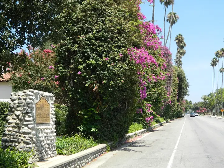
A bougainvillea so big it's on the National Register of Historic Places. That's the Glendora Bougainvillea. Planted in 1901 by the Hamlins, early citrus growers, it's the largest bougainvillea in the United States. But here's the odd part: the original parent plant arrived in 1870 on a whaling ship. A whaling ship. Somehow, a tropical vine from South America hitched a ride on a vessel hunting whales, and ended up in a California citrus grove. The vine now climbs 94-foot palm trees and stretches 600 feet down two streets. It's a living piece of the early 20th-century dream of California as paradise.
Lorecast plays short stories about the places around you, hands-free. Download Route 66 before you leave and it works offline. Route 66 is free through December 31, 2027.
How these stories are made
Lorecast stories are written with AI using only the sources listed under each story, and they are narrated with synthetic voices. An automatic check traces every name and date back to those sources, and legends are told as legends. Every story on this page was also checked against its sources before we published it here. If you spot a mistake, write to hello@lorecast.net.