A Pecos River town between Tucumcari and Albuquerque, where Route 66 traffic made it a popular rest stop with motels and cafes.
1,260 mi from Chicago
3 stories to hear
Free in the app through 2027
Allow one cookie to recognise return visits? No cross-site tracking. Privacy
About Santa Rosa
The first settlement here, in 1865, was Agua Negra Chiquita, “Little Black Water.” In 1890 it took the name Santa Rosa from a chapel that founder Don Celso Baca named for his mother Rosa and Saint Rose of Lima. Two railroads arrived in 1901 and 1902, and in 1903 the county seat moved here from Puerto de Luna.
The highway through town became US 66 in 1926, and the main street is still called Route 66. The town’s natural lakes are water-filled sinkholes. For The Grapes of Wrath, John Ford filmed the train scene here, with a freight train crossing the Pecos River railroad bridge.
On the road, Lorecast plays these on its own as you drive past each place. Here you can listen first. Each story lists its sources.
HISTORY · TOLD BY MILES · 49 SEC
The Blue Hole
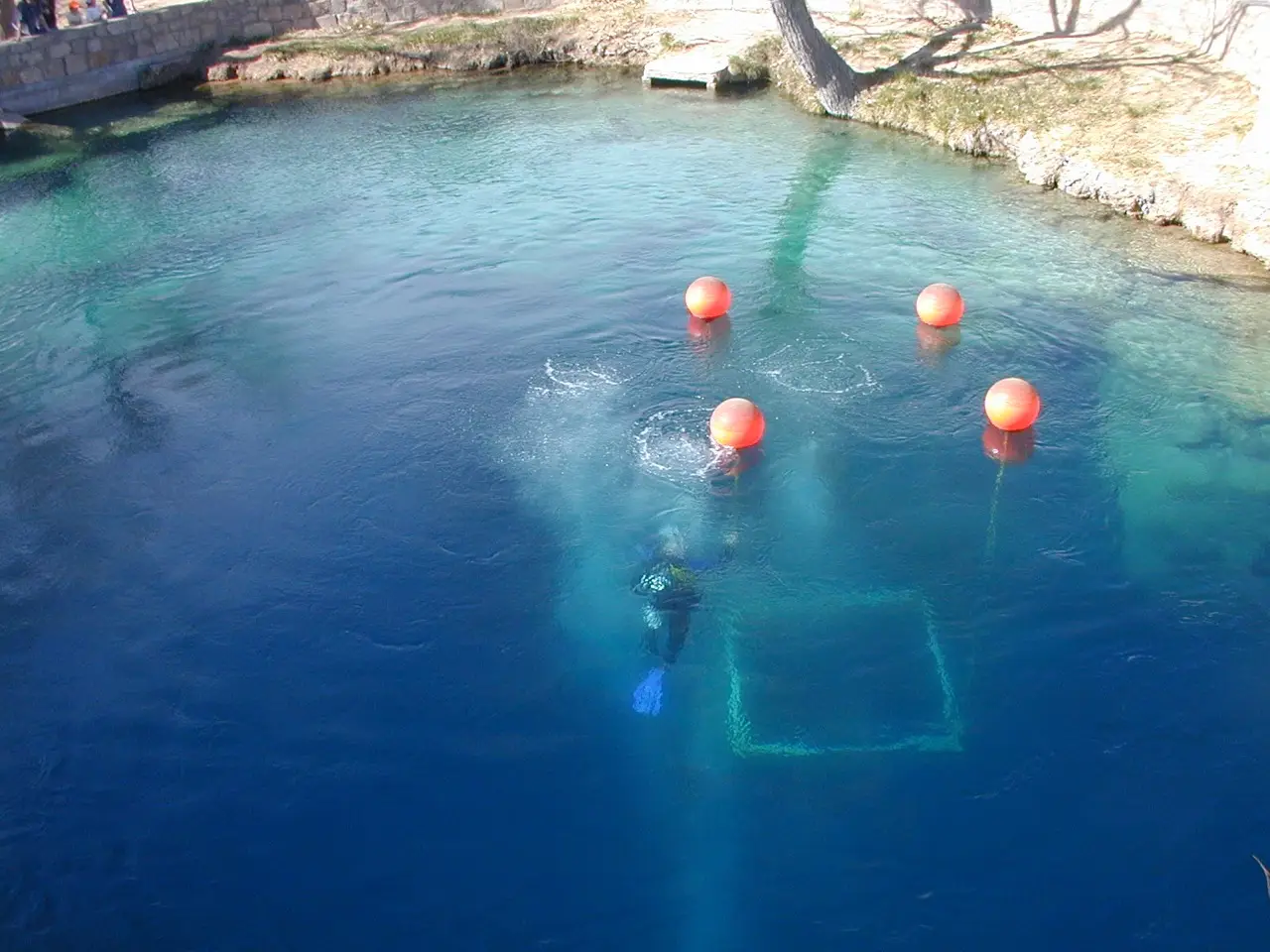
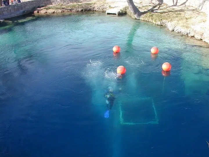
The Blue Hole of Santa Rosa is a circular, bell-shaped pool along Route 66. It's an artesian well and cenote, once used as a fish hatchery. The water is a constant 62°F, flowing in at 3,000 gallons per minute—enough to cycle the entire pool every six hours. The surface is 80 feet across, but it widens to 130 feet at the bottom, and the depth exceeds 80 feet. That water comes from deep underground, from the western edge of the Ogallala Aquifer, over 200 feet down. So this isn't just a swimming hole; it's a natural spring that's become one of the most popular dive destinations in the US for scuba diving and training.
Here's a riddle for you: an airport with two runways, one of which used to be a highway. That's Santa Rosa Route 66 Airport. The original runway, 08-26, was literally a section of old U.S. Highway 66 before Interstate 40 was built. So you could, in theory, drive a car down the same strip where planes now land. The second runway came along in the mid-1990s. But here's the truly odd bit: the FAA code for this airport is SXU, but the IATA — the international code system — gave SXU to a place in Ethiopia called Soddu. So this airport has no IATA code at all. It's like the aviation world forgot it existed. A runway that was a road, and a code that belongs to someone else. That's the kind of quiet weirdness you only find on the old alignments of Route 66.
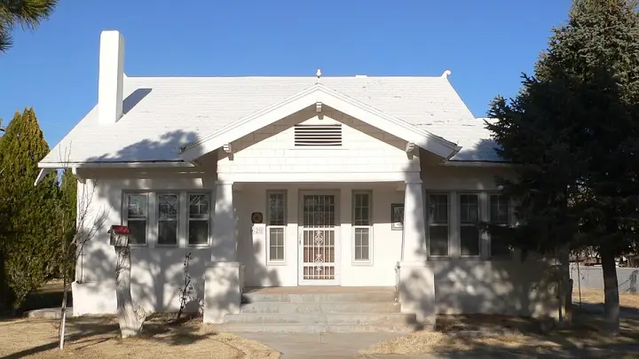
You'd expect a 1917 house in Santa Rosa to be straightforward — four walls, a roof, maybe a porch. But this one? It's a Craftsman bungalow that went all in. The porch piers are battered, like they're bracing for something. Inside, oak molding and stenciled wall patterns — someone cared about every inch. The back porch got enclosed at some point, yet the whole thing still holds its integrity. It's a house that refused to be ordinary, and it made the National Register in 1982 for exactly that reason.
A circular artesian pool along Route 66, more than 80 feet deep and a constant 62°F. It is open for swimming, snorkeling and diving; the caves below have been sealed off to the public since 1976.
A 25-acre municipal park on a lake, built under the Works Progress Administration between 1934 and 1940 as a Depression-era make-work project. It was listed on the National Register in 1996.
A two-story 1909 red sandstone courthouse at Fourth Street and Parker Avenue. Carved sandstone eagles and urns stood at the four corners of the roof; by its 1987 nomination, only one eagle remained.
A public-use airport three nautical miles east of downtown. Its original runway, 08-26, was a section of old U.S. Highway 66 before Interstate 40 was built.
Santa Rosa is about 1,260 miles from Chicago along the route. It is on day 8 of our 14-day plan.
Clines Corners 57 mi west
Roy E. Cline built a rest stop here in 1934, at what was then the junction of US 66 and US 285. Today the Clines Corners Retail Center covers more than 30,000 square feet.
Let Santa Rosa tell its own stories as you drive in.
Lorecast plays short stories about the places around you, hands-free. Download Route 66 before you leave and it works offline. Route 66 is free through December 31, 2027.
How these stories are made
Lorecast stories are written with AI using only the sources listed under each story, and they are narrated with synthetic voices. An automatic check traces every name and date back to those sources, and legends are told as legends. Every story on this page was also checked against its sources before we published it here. If you spot a mistake, write to hello@lorecast.net.