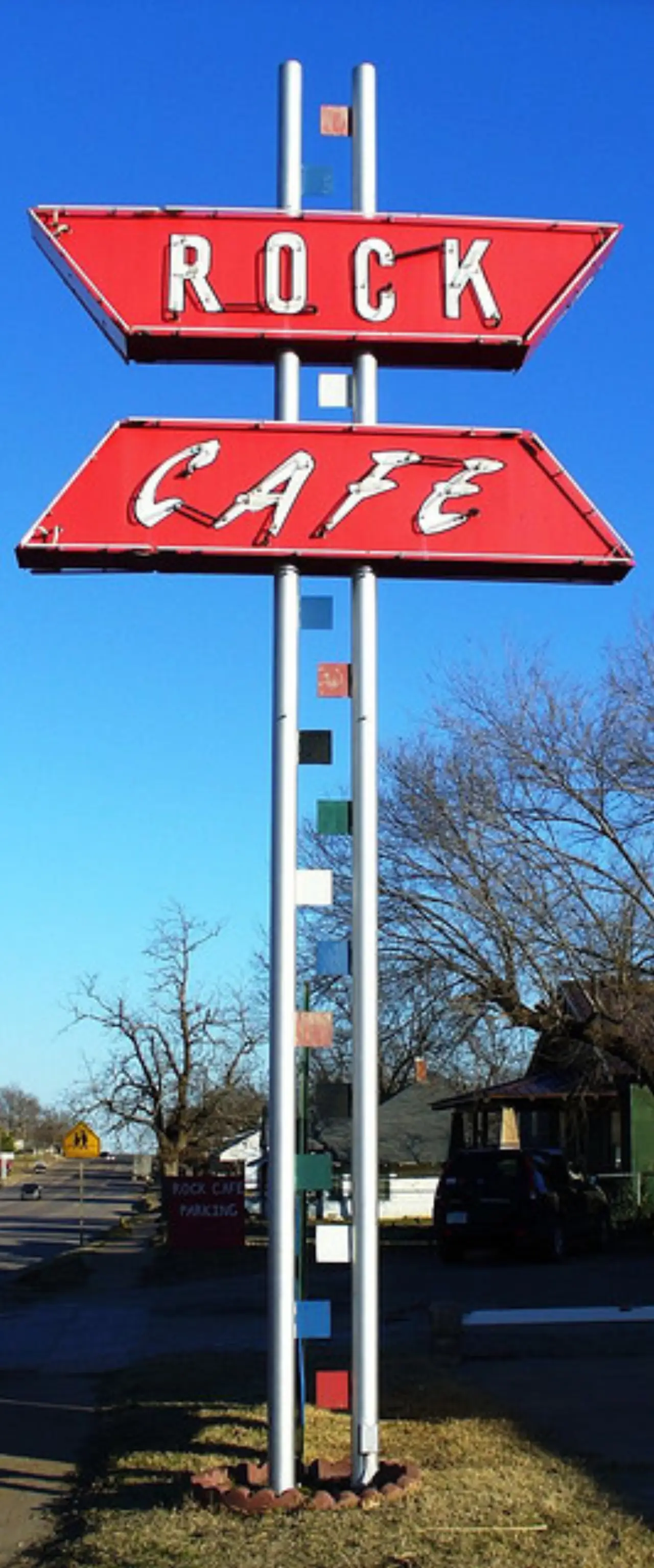
Founded in 1892, Stroud became a Route 66 rest stop of motels, gas stations and restaurants, among them the 1939 sandstone Rock Café.
770 mi from Chicago
3 stories to hear
Free in the app through 2027
Allow one cookie to recognise return visits? No cross-site tracking. Privacy
About Stroud
Stroud was founded in 1892 and named for developer James W. Stroud. It lay in Oklahoma Territory, where liquor was legal, close to the line with “dry” Indian Territory, and its saloons gave it a “wild” name until statehood made it dry in 1907.
Route 66 reached Stroud in 1926, and the town became a rest stop with motels, gas stations and restaurants. The Turner Turnpike later pulled traffic off Main Street, and a 1999 tornado destroyed the town’s outlet mall. In 2001 Pixar crews researching Cars stopped at the Rock Café.
On the road, Lorecast plays these on its own as you drive past each place. Here you can listen first. Each story lists its sources.
HISTORY · TOLD BY MILES · 76 SEC
How the Rock Café was built, and rebuilt
In 1936, in the middle of the Dust Bowl, a man named Roy Rieves started building a restaurant out of local sandstone. He paid $100 for the land and $5 for leftover Kellyville stone from the Route 66 roadwork. He did most of the construction himself, hiring students when he needed help. The Rock Café opened in August 1939, with Miss Thelma Holloway as the first manager. During World War II, it was a busy Greyhound bus stop. In 1959, Mamie Mayfield ran it twenty-four hours a day, and she didn't retire until she was 70, in 1983. Then came the interstate, then Route 66 was decommissioned, and the café faded. In 1993, Dawn Welch bought it. A tornado hit in 1999, damaging the neon sign and cutting business in half. But the café was listed on the National Register in 2001, and that brought grants for restoration. Then Pixar researchers stopped by, and Dawn Welch became the inspiration for Sally Carrera in *Cars*. In 2008, a fire nearly finished it off, but preservationist David Burke rebuilt it, and it reopened in 2009.
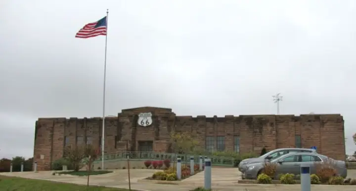
The Chandler Armory in Chandler, Oklahoma looks like a fortress of local red sandstone. It was built between 1935 and 1937 by the Works Progress Administration as a home for Battery F, Second Battalion of the 160th Field Artillery of the Oklahoma National Guard. The architect was Nolan, a local man and a National Guard officer himself. The building has two parts: the eastern section with gun bays, offices, classrooms, and a magazine under a barrel-vaulted roof; the western half is a wooden-floored drill hall with a stage and a narrow rifle range beneath it. After the military left in 1971, the armory sat vacant until 2007, when it became the Route 66 Interpretive Center. The museum is unusual—few physical exhibits, but audio-visual installations like footage shot from a 1965 Ford Mustang. You can even relax on a bed in a virtual hotel room to watch the material on an overhead screen. And yes, the building apparently has the only brick outhouse in Oklahoma, complete with its original French fixture.
Stroud, Oklahoma — a town that was, for a few years, a legal loophole on legs. Founded in 1892, it sat right on the border between Oklahoma Territory, where alcohol was legal, and Indian Territory, where it wasn't. So thirsty cowboys and travelers from the dry side would ride into Stroud for a drink. The place earned a reputation as a "wild" town, packed with saloons and all the businesses that follow. But the party ended fast: Oklahoma statehood in 1907 made Stroud dry too. A short, boozy heyday, then back to quiet.
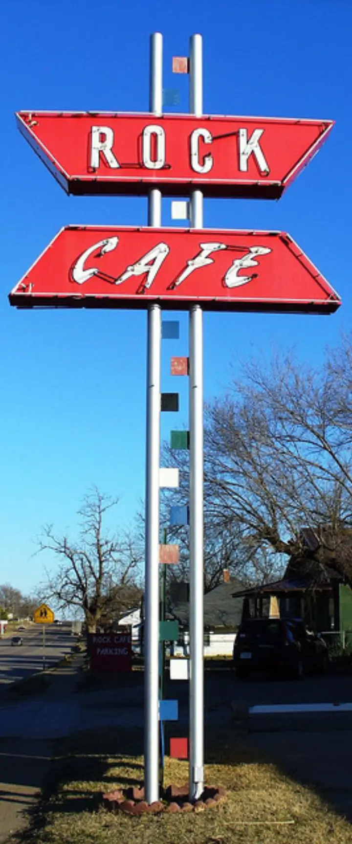
Built of Kellyville sandstone left over from Route 66 roadwork and opened in 1939. It came through a 1999 tornado, was rebuilt after a 2008 fire, and reopened in 2009.
Stroud’s oldest and best-preserved Prairie Style house, built in 1913 at 204 West 6th Street for hardware merchant Joseph R. Carpenter and designed by an architect from Kansas City.
In Chandler: a red sandstone WPA armory of 1935–37 that now holds the Route 66 Interpretive Center, where you can watch old-highway footage from a bed in a virtual hotel room.
Chandler also has Route 66 murals, a restored cottage-style Phillips 66 station, and one of the last painted barns advertising Meramec Caverns, the Missouri cave on Route 66.
Old Route 66 runs through the center of Bristow. Its 102-foot Chrysler Plymouth tower, built in 1947 to be seen from Route 66, was moved closer to the highway and relit on April 11, 2026.
The Ozark Trail Highway reached Davenport in 1916 and became Route 66 through town in 1926. Its Broadway Avenue brick street is on the National Register, and murals around town show its early history and Route 66.
Lorecast plays short stories about the places around you, hands-free. Download Route 66 before you leave and it works offline. Route 66 is free through December 31, 2027.
How these stories are made
Lorecast stories are written with AI using only the sources listed under each story, and they are narrated with synthetic voices. An automatic check traces every name and date back to those sources, and legends are told as legends. Every story on this page was also checked against its sources before we published it here. If you spot a mistake, write to hello@lorecast.net.