Tulsa is where Cyrus Avery founded the U.S. Highway 66 Association in 1925, earning the city its nickname, the “Birthplace of Route 66.”
720 mi from Chicago
5 stories to hear
Free in the app through 2027
Allow one cookie to recognise return visits? No cross-site tracking. Privacy
About Tulsa
Tulsa sits on the Arkansas River. The Lochapoka band of Creek people settled here between 1828 and 1836, and the town was incorporated in 1898. Oil was struck near Red Fork in 1901, and for most of the 20th century Tulsa was known as the “Oil Capital of the World,” a boom that filled downtown with Art Deco buildings.
In 1925 Tulsa businessman Cyrus Avery set up the U.S. Highway 66 Association here. The highway came in on Southwest Boulevard and crossed the river on the 11th Street Bridge; from 1932 it ran east along 11th Street. Twenty-nine historical markers now line its 26 miles through the city.
On the road, Lorecast plays these on its own as you drive past each place. Here you can listen first. Each story lists its sources.
HISTORY · TOLD BY MILES · 74 SEC
The bridge that brought Route 66 to Tulsa
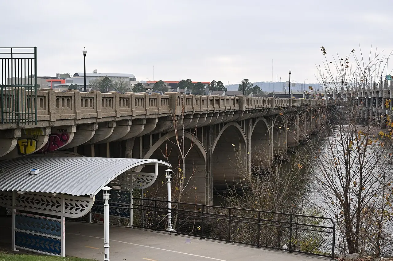
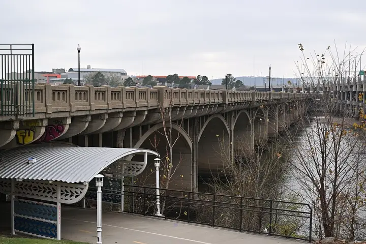
In 1915, a bridge was completed across the Arkansas River at Tulsa, Oklahoma. It was the first bridge built specifically for automobiles to cross that river, and at 1,470 feet, it was one of the longest concrete structures in the Midwest. For decades, it carried Route 66. But by 2008, the bridge was in such poor condition that the gates were locked even to pedestrians. Holes in the deck, buckled pavement, weeds in the cracks. Engineers said it would cost $15 million just to make it safe to walk on. The verdict: "too expensive to repair, too historic to demolish, and too valuable to ignore." So it still stands—closed, crumbling, but honored. In 2004, it was renamed for Cyrus Avery, the man who championed Route 66. And at its east end, a plaza features a bronze sculpture called "East Meets West"—the Avery family in a Model T, meeting a horse-drawn carriage. A moment frozen in time, on a bridge that time has left behind. Want to know more about the bridge's history?
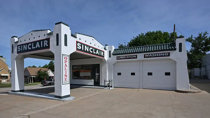
A gas station with a tile roof? That's not your everyday fill-up stop. The Sinclair Service Station in Tulsa wears a stucco exterior, a triangular parapet, and a Ludowici-tiled visor roof—details that earned it a spot on the National Register of Historic Places back in 1996. The nomination calls it "an excellent example of a Spanish Eclectic service station." And the whole place is built in three parts: an office, a covered gas pump area, and an attached double-bay service garage. It sits along Route 66—actually, its listing was consistent with a study of historic resources on that famous road. So next time you think a gas station is just a box for pumping fuel, remember this one thought it deserved a little architectural flair.
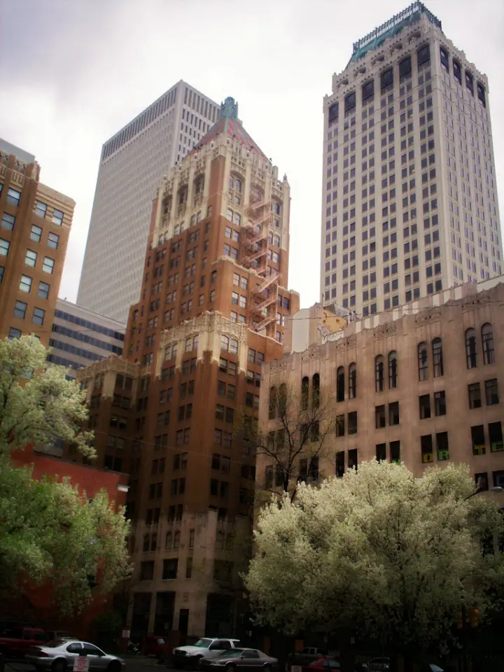
An oilman once gave away a skyscraper to the Boy Scouts. No, really. Waite Phillips, who made his fortune in Oklahoma oil, finished this neo-Gothic tower in 1928. Then in 1941, he deeded the Philtower to the Boy Scouts of America — along with most of his Philmont Ranch. The building's income helped support the ranch. Imagine a troop of Scouts owning a 24-story office building. They sold it in 1977 to local investors. Today, the 21st-floor office where Phillips worked is still preserved. The vaulted lobby ceiling? Carved stone rosettes made in Italy, reassembled by the same craftsmen. Quirky? Absolutely.
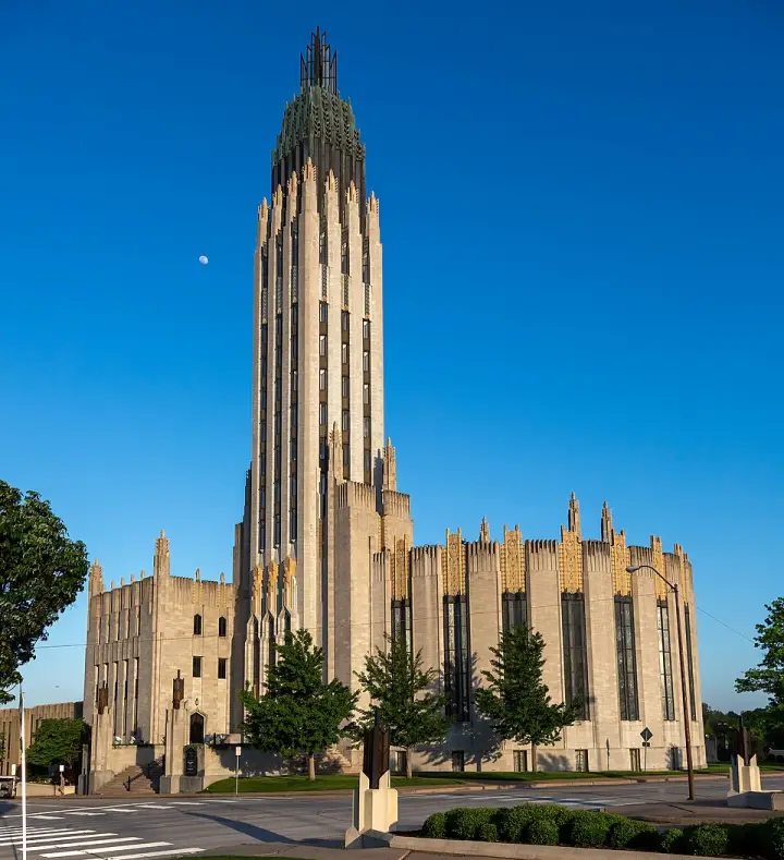
You'd expect a church like this to be designed by a famous architect. But the Boston Avenue Methodist Episcopal Church in Tulsa? Its design is credited to two people: a high school art teacher and her former student. Adah Robinson sketched the original ideas. Bruce Goff, who had been in her class, took those sketches and turned them into the soaring Art Deco masterpiece you see here. Completed in 1929, the building cost $1.25 million. Its 225-foot tower is topped with a sculpture of two hands raised in prayer—a motif Robinson drew early on. The exterior is covered in terra cotta sculptures by Robert Garrison, another of Robinson's students. There's still debate over who deserves more credit. The church says Robinson; Goff experts say Goff. The definitive book on Tulsa Art Deco refuses to settle it. Either way, it's one of the finest examples of ecclesiastical Art Deco in the country, designated a National Historic Landmark in 1999.
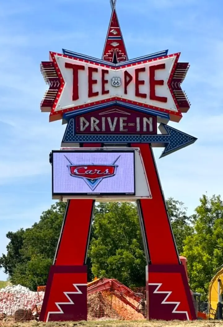
The Tee Pee Drive-In opened on May 5, 1950. It was built with paved pathways, unlike most drive-ins of the time that used dirt. For a decade, it ran smoothly, showing movies to thousands. Then, on its tenth anniversary—May 5, 1960—an F5 tornado tore through the area. It nearly destroyed the theater. But within a month, it was repaired and back in business.
The 1915 arch bridge that carried Route 66 over the Arkansas River, now closed. Cyrus Avery Centennial Plaza, with its “East Meets West” sculpture, is at the east end; a neon sign park opened at the west end in 2020.
An open-air museum at 3770 Southwest Boulevard: a 194-foot oil derrick at the site of Tulsa’s first oil strike, a visitor center modeled on a 1920s–30s gas station, and the Frisco 4500 steam locomotive.
A 1934 neon sign built for the Beatrice Dairy Company and now a Route 66 landmark. When its building was demolished in 2004, it moved to a brick pavilion at East 11th Street and South Quaker Avenue.
A 1929 Spanish Eclectic filling station at 3501 E. 11th Street, on the original Route 66: office, covered pump area and double-bay garage, with stucco walls and a Ludowici-tiled visor roof.
Oilman Waite Phillips’s 24-story tower of 1928 at 427 South Boston Avenue, known for its illuminated, sloping tiled roof. He deeded it to the Boy Scouts of America in 1941 to help support Philmont Ranch.
An Art Deco church with a 225-foot tower crowned by praying hands, designed by art teacher Adah Robinson and her former student Bruce Goff. It became a National Historic Landmark in 1999.
Hugh Davis built the whale in the early 1970s as a surprise for his wife, Zelta, and its pond became a swimming hole for Route 66 travelers. It was restored in 1997; swimming is no longer allowed.
A drive-in on an old alignment of Route 66 that opened in 1950. It closed in 1999, sat abandoned for just over two decades, and reopened on April 15, 2023.
Lorecast plays short stories about the places around you, hands-free. Download Route 66 before you leave and it works offline. Route 66 is free through December 31, 2027.
How these stories are made
Lorecast stories are written with AI using only the sources listed under each story, and they are narrated with synthetic voices. An automatic check traces every name and date back to those sources, and legends are told as legends. Every story on this page was also checked against its sources before we published it here. If you spot a mistake, write to hello@lorecast.net.