Illinois finished its share of Route 66 first: the road from Chicago to St. Louis was almost entirely paved by 1924.
310 mi along our route
3 towns in this guide
19 stories to hear
Allow one cookie to recognise return visits? No cross-site tracking. Privacy
Route 66 in Illinois
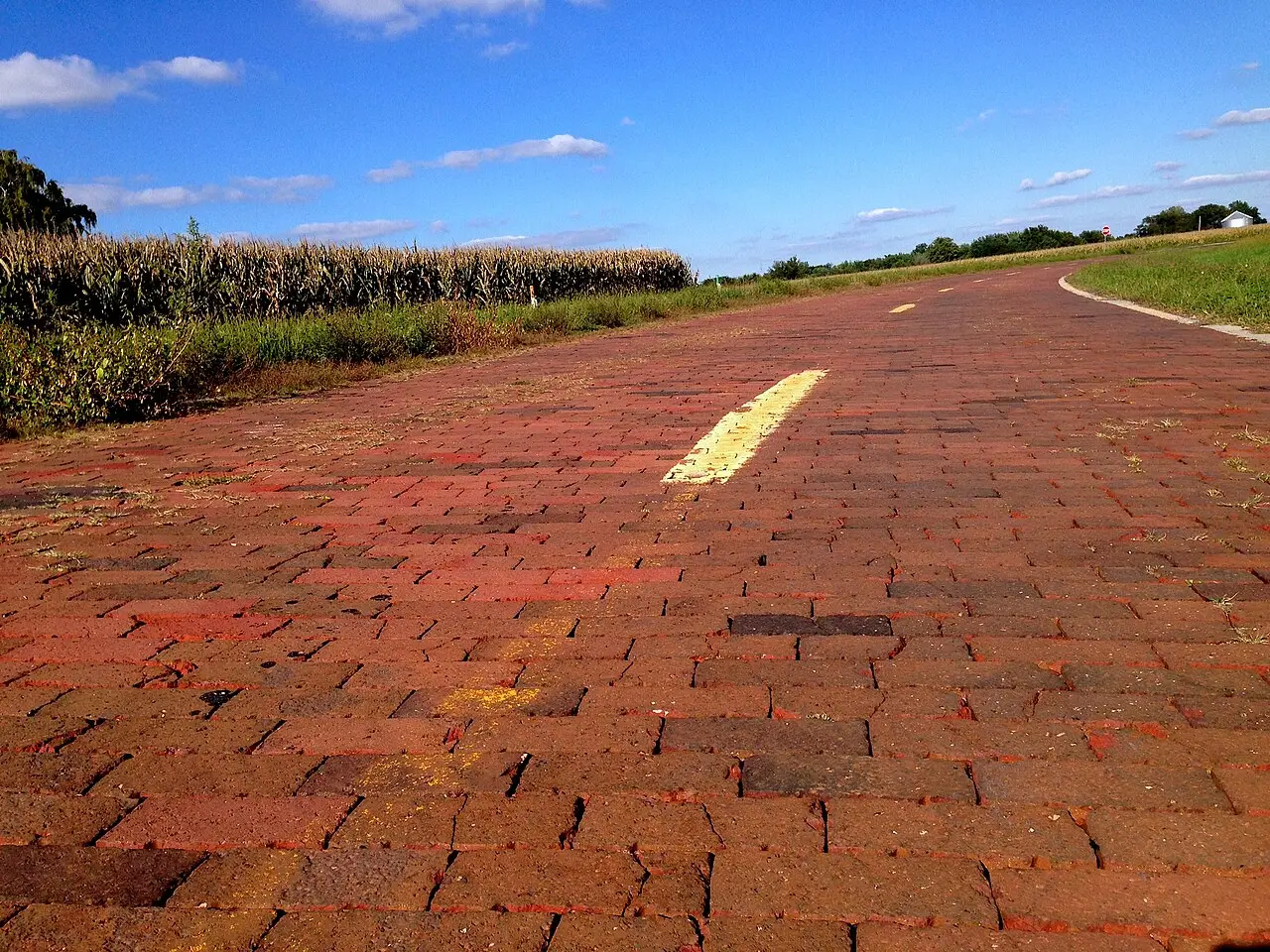
Route 66 ran about 301 miles across Illinois, from downtown Chicago to the Mississippi River at St. Louis. It followed Illinois Route 4, which traced the old Pontiac Trail and ran close beside the Chicago and Alton Railroad.
The road moved more than once. In 1930 a bypass crossed the Chain of Rocks Bridge around St. Louis, in 1940 a new route skirted Joliet through Plainfield, and in 1957 Route 66 moved onto a new freeway that became the first complete section of Interstate 55 in Illinois.
Today I-55 has largely replaced the old road, but parts of it still carry traffic, often as frontage roads beside the interstate. Six stretches of the old roadbed are on the National Register of Historic Places, and the whole Illinois route is a National Scenic Byway.
Stories Lorecast plays on the open road in Illinois, in the order you reach them driving west.
HISTORY · TOLD BY MILES · 70 SEC
Dell Rhea's Chicken Basket, Willowbrook
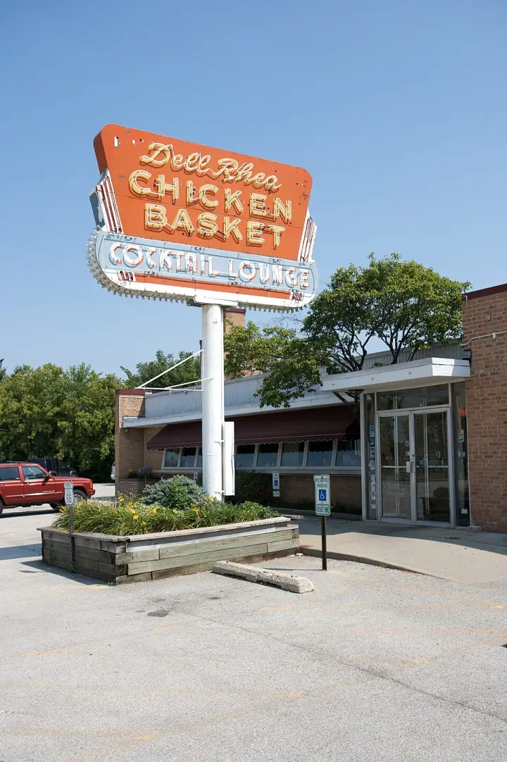
What makes a gas-station lunch counter turn into a fried-chicken landmark? In the late 1920s, Ervin 'Irv' Kolarik sold sandwiches from a gas station along Route 66. Then, in 1938, two local farm women stopped for coffee and overheard him grumbling that he'd rather run the lunch counter. They offered their secret fried-chicken recipe on one condition: he'd buy his birds from them. He agreed, they went to work, and the chicken was an instant hit. Kolarik turned the station's old repair bays into dining rooms, and by the mid-1940s he built a one-story brick restaurant next door, opened in 1946. He even flooded the roof in winter and hired local kids to ice-skate on it for publicity. The interstate bypass nearly killed it, but in 1963 Delbert Rhea bought it, added his name, and kept the recipe. The building and its classic freestanding neon sign landed on the National Register of Historic Places on May 5, 2006.
Ever hear of a restaurant that was bought on a coin flip? Family legend has it that Bob Hastert Sr.—the man who took over White Fence Farm back in 1954—settled the purchase price with the previous owner, an acquaintance who had gone bankrupt, by simply flipping a coin. That's the story they tell in the family, anyway. And it's the kind of tale that sticks with you, because it says something about chance, and about the strange way this place on Route 66 kept changing hands before it found its footing. Bob Sr. wasn't a gambler by trade. He'd started as a wholesale poultry dealer at the Aurora Poultry Market during World War II, then opened the Harmony House restaurant in Aurora. So he knew the business. But the coin flip? That was a different kind of risk. One toss, and suddenly he owned a roadside farmhouse restaurant with a history already stretching back to the 1920s—back when the founder, Jack Peabody, ran it as a spot for hamburger sandwiches and Guernsey milk ice cream. The property had passed through several operators after the Peabody estate sold it. And then Bob Sr. came along, flipped a coin, and made it his. What happened next is well-documented. He added the famous fried chicken recipe in the 1950s, and the place grew—dining rooms seating over a thousand, a petting zoo, an antique car collection. His son, Bob Jr., even converted an industrial-sized hospital autoclave into an outsized pressure cooker for the chicken. But for all that expansion, the most human detail remains that coin. Bob Sr. told the story himself? The legend doesn't say. It just says the price was settled with a flip. And the family kept telling it. His granddaughter runs the place now, carrying on the name. So next time you bite into that fried chicken—pressure cooked, flash-fried, served with corn fritters and a brandy ice—remember the coin that may have decided it all. Chance is a strange cook.
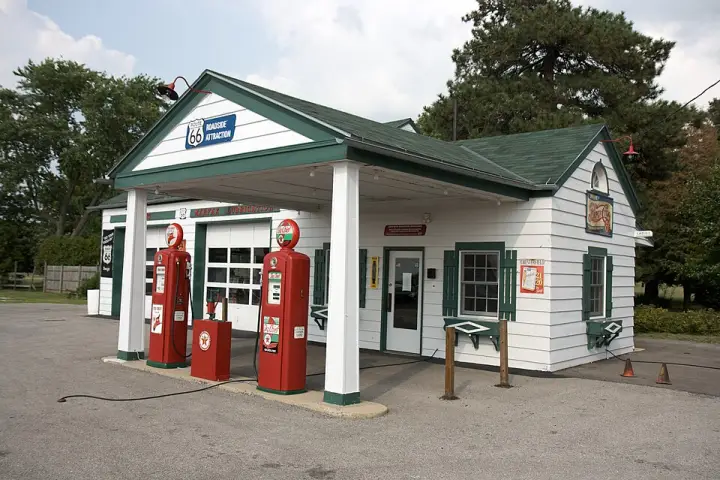
In Dwight, Illinois, there's a gas station that pumped fuel for 66 straight years — the longest stretch on all of Route 66. It opened in 1933, built by Jack Schore. But the man who gave it its name was Basil "Tubby" Ambler, who owned it from 1938 to 1966. After him, the station changed hands a few times until a local kid named Phil Becker — who'd been hanging around since he was nine — bought it in 1970. He ran it with his wife Debbie until 1996, then donated it to the village. In 2005, a restoration brought it back to its 1940s look, and it reopened as a visitor center in 2007. Inside, you'll find a potbelly stove, an old cash register, and even a plaid stamp saver book.
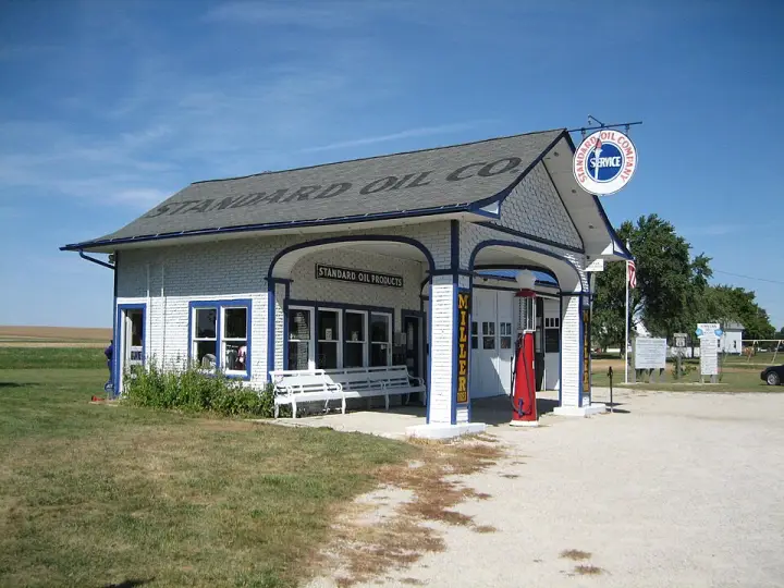
In 1932, a contractor named Patrick O'Donnell bought a small plot of land on the southwest side of Odell, Illinois. His plan wasn't to run a business himself—he built a gas station to lease to his son. That station, a Standard Oil outlet, sat along historic U.S. Route 66, serving travelers before the interstate system rerouted the world. It's a typical station for the corridor, but its story is anything but: a father building a future for his son, one tank of gas at a time.
What started as a sandwich stand in a mechanic's garage in 1928? That's the Dixie Travel Plaza. Walters and John Geske opened it on old Route 66 in McLean, Illinois. By 1930, demand had already forced them to expand into a full restaurant. It grew from there—expanded several times, rebuilt after a 1965 fire. For over fifty years, from 1926 to 1977, it helped define the character of Route 66. The Route 66 Association of Illinois inducted them into their hall of fame in 1990. A truck stop that started small and became a legend.
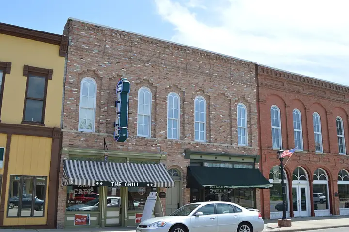
The Downey Building in Atlanta, Illinois, was built in 1867 by local businessman Alexander Downey. It's Italianate, two storefronts, and from the start it housed the only bank in town—the Exchange National Bank of Atlanta, chartered the year before after the previous bank shut down. That bank changed names a couple of times, then moved out in 1916. John Luther Bevan took over the space for his law office, and his son Samuel used it until 1960. The north storefront had a string of businesses until 1934, when James Robert Adams opened the Palms Grill Café. It became a community hub—dances, bingo, and the Greyhound bus stop. A big neon sign out front signaled the buses. The grill closed in the 1960s, but in 2009, after a major renovation, it reopened. Now it's a popular stop on Historic Route 66. The building was listed on the National Register in 2004.
Lorecast plays short stories about the places around you, hands-free. Download Route 66 before you leave and it works offline. Route 66 is free through December 31, 2027.
How these stories are made
Lorecast stories are written with AI using only the sources listed under each story, and they are narrated with synthetic voices. An automatic check traces every name and date back to those sources, and legends are told as legends. Every story on this page was also checked against its sources before we published it here. If you spot a mistake, write to hello@lorecast.net.